Devgarh, Lalitpur
Devgarh, Lalitpur, Uttar Pradesh 284403
Overiew
Devgarh village lies on the right bank of the Betwa River, at the point where it joins the reservoir formed by the Rajghat Dam. The village is at the western end of the Lalitpur hill range, situated 23 kilometres (14 mi) south-east from Lalitpur town in Lalitpur district and 123 kilometres (76 mi) south of the divisional administrative centre at Jhansi. The village is spread over an area of 5 square kilometres (1.9 sq mi) with an average elevation of 211 metres (692 ft).
The fort of Deogarh is in a valley which generally has a gentle slope. The valley is formed by the Betwa River at the western end of the hills of the Vindhya Range. Known earlier as Vetravati (Sanskrit, meaning "containing reeds"), the Betwa River is a tributary of the Yamuna River, and skirts the foot hill on its southern side. The river, flowing at a bend near the fort, has a rocky bed. It flows in a cascade of deep pools with steep rocky banks of sandstone formations. The fort is located on a precipice of the steep cliff, just above the river on its right bank.
Visitor Attractions
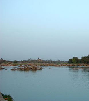
Betwa River
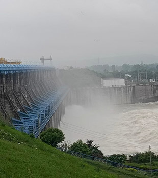
Rajghat Dam
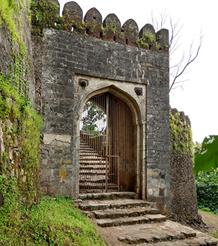
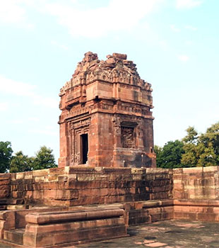
Fort of Devgarh
Monuments